In 2019, a team of researchers from New York University and Rutgers University examined ways to calibrate and develop Safety Performance Functions (SPFs) to be utilized specifically to address conditions on New Jersey roadways. SPFs are crash prediction models or mathematical functions informed by data on road design. These data include, but are not limited to, lane and shoulder widths, the radius of the curves, and the presence of traffic control devices and turn lanes. With these data, SPFs help those tasked with road design and improvement to build roads and implement upgrades that maximize safety.
The Highway Safety Manual (HSM) presents SPFs developed using historic crash data collected from several states over several years at sites of the same facility type. These SPFs data cannot be transferred to other locations because of expected differences in environment and geographic characteristics, crash reporting policies and even local road regulations. To help SPFs better reflect local conditions and observed data, one of two strategies is usually undertaken to fine-tune SPFs: calibrating the SPFs provided in the HSM so as to fully leverage these data or developing location-specific SPFs regardless of the predictive modeling framework included in the HSM.
The research team, led by Dr. Kaan Ozbay (of NYU’s Tandon School of Engineering), chose to pursue both of these strategies. The research report, Calibration/Development of Safety Performance Functions for New Jersey, can be found here. A webinar highlighting the research and findings can be found here. A monograph, supported by the NJDOT funded study and partially by C2SMART, a Tier 1 UTC led by NYU and funded by the USDOT, was also recently published and can be found here.
SPFs can be utilized at several levels. At the network level, researchers and engineers use SPFs to identify locations with promise for improvement. SPFs can be used to predict how safety treatments will affect the likelihood of crashes based on traffic volume and facility type. SPFs can be used to influence project level design by showing the average predicted crash frequency for an existing road design, for alternate designs, and for brand-new roads.
SPFs also can be used to evaluate different engineering treatments. In this case, engineers and researchers return to a site where a safety countermeasure has been installed to collect and analyze data to see how the change has affected crash frequency. They examine before and after conditions and measure if the prediction made using the SPF was accurate or needs improvement (Srinivasan & Bauer, 2013). In the end, SPFs are only as good as the data used in their development.
NJDOT and the NYU-Rutgers team set out to calibrate SPFs using New Jersey’s roadway features, traffic volumes and crash data, and if necessary, to create new SPFs that reflect conditions in the state. The facility types considered for this research project included segments and intersections of rural two-lane two-way, rural multilane, and urban and suburban roads. In examining these datasets, the researchers identified areas where data processing improvements could be made to enhance the quality or efficiency in use of the data in addition to pursuing the stated goal of developing New Jersey-specific SPFs.
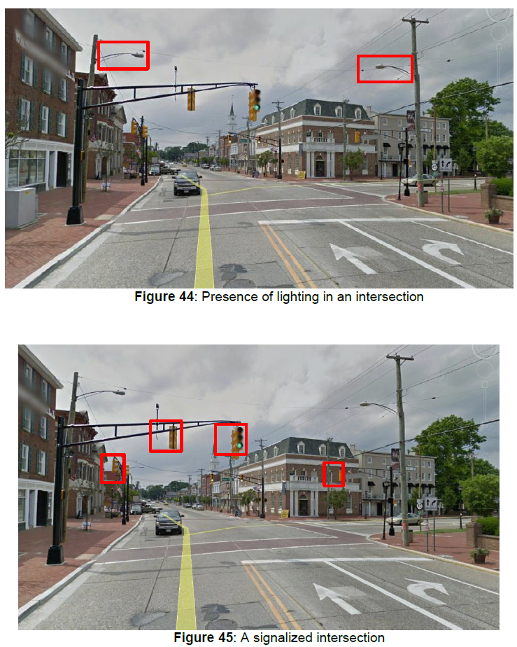
For example, utilizing the data provided by NJDOT, the research team developed methods for processing a Roadway Features Database of different kinds of road facilities. The researchers utilized the Straight Line Diagrams (SLD) database, which offers extensive information about the tens of thousands of miles of roadways in New Jersey, but observed issues and errors in the SLD database that required corrections. For example, the research team utilized Google Maps and Google Street View to conduct a manual data extraction process to verify information in the SLD database (e.g., confirm whether an intersection was an overpass, number of lanes, directionality) and extract missing variables, such as the number of left and right turn lanes at intersections, lighting conditions, and signalization needed for the analysis.

The research team also needed to develop programming code to correctly identify the type and location of intersections and effectively work with available data. The team developed a novel “clustering-based approach” to address the absence of horizontal curvature data using GIS centerline maps.

Police reports of crashes often have missing geographic identifiers which complicates analytical work such as whether crashes were intersection-related. In NJ, police are equipped with GPS devices to record crash coordinates but this crash information is somewhat low in the raw crash databases before post-processing by NJDOT. The researchers employed corrective methods and drew upon other NJ GIS maps to provide missing locations (e.g., Standard Route Identification or milepost).
The processing challenges for roadway features, traffic volumes and crashes encountered by the research team suggest the types of steps that can be taken to standardize and streamline data collection and processing to secure better inputs for future SPF updates. Novel data extraction methods will be needed to minimize labor time and improve accuracy of data; accurate crash data is integral to employing these methods.
The research team modified the spreadsheets developed by the HSM and used by the NJDOT staff. The calculated calibration factors and the developed SPFs are embedded in these spreadsheets. The users can now select whether to use the HSM SPFs with the calculated calibration factors or the New Jersey-specific SPF in their analyses
The researchers’ data processing and calibration efforts sought to ensure that the predictive models reflect New Jersey road conditions that are not directly reflected in the Highway Safety Manual. The adoption of this data-driven approach can make it possible to capture information about localized conditions but significant expertise is required to carry out calibration and development analyses. With more research—and improved data collection processes over time —the calibration and development of SPFs holds promise for helping New Jersey improve road safety.
Resources
Bartin, B., Ozbay, K., & Xu, C. (2022). Safety Performance Functions for Two-Lane Urban Arterial Segments. Retrieved from https://papers.ssrn.com/sol3/papers.cfm?abstract_id=4175945
C2SMART. (2020, September 23). Webinar: Bekir Bartin, Calibration and Development of Safety Performance Functions for New Jersey . Retrieved from YouTube: https://youtu.be/IRalyvjDaFM
Ozbay, K., Nassif, H., Bartin, B., Xu, C., & Bhattacharyya, A. (2019). Calibration/Development of Safety Performance Functions for New Jersey [Final Report]. New Jersey Department of Transportation Bureau of Research. Retrieved from https://www.njdottechtransfer.net/wp-content/uploads/2020/07/FHWA-NJ-2019-007.pdf
Ozbay, K., Nassif, H., Bartin, B., Xu, C., & Bhattacharyya, A. (2019). Calibration/Development of Safety Performance Functions for New Jersey [Tech Brief]. Rutgers University. Department of Civil & Environmental Engineering; New York University. Tandon School of Engineering. Retrieved from https://www.njdottechtransfer.net/wp-content/uploads/2020/07/FHWA-NJ-2019-007-TB.pdf
Srinivasan, R., & Bauer, K. M. (2013). Safety Performance Function Development Guide: Developing Jurisdiction-Specific SPFs. The University of North Carolina, Highway Safety Research Center. Retrieved from https://rosap.ntl.bts.gov/view/dot/49505

