NJLTAP – Safe Transportation for Every Pedestrian Workshop

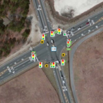
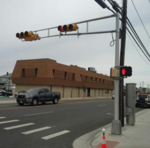
Safe Transportation for Every Pedestrian (STEP) is a Federal Highway Administration Every Day Counts (EDC-5) initiative.  The NJ Local Technical Assistance Program (NJLTAP), in association with NJDOT and FHWA, is holding an all-day workshop training event on October 31st with an instructor from FHWA Resource Center’s Safety & Design Technical Service Team.  The workshop training will provide an overview of the pedestrian safety crossing problem and identify resources and strategies for addressing it.

Pedestrian fatalities are on the rise, and account for more than 16% of all traffic fatalities nationwide. New Jersey is a pedestrian safety focus state, meaning we have more pedestrian fatalities than the national average, at about 25%.  The “Spectacular 7” safety treatments to address pedestrian safety crossing problems will be reviewed. These are:

  • Rectangular rapid flashing beacons (RRFBs)
  • Leading pedestrian intervals (LPIs)
  • Crosswalk visibility enhancements
  • Raised crosswalks
  • Pedestrian crossing/refuge islands
  • Pedestrian hybrid beacons
  • Road diets

This is a full-day workshop with a group field exercise where participants will evaluate a nearby location for pedestrian safety and make recommendations for improvement if needed.

Agenda:

  • Welcome and Introductions
  • Why STEP: Background and Data
  • Policies and Process
  • STEP Treatments
  • Site Visit
  • Report Out
  • Final Remarks and Evaluation

Instructor: Peter Eun, Transportation Safety Engineer, FHWA Resource Center’s Safety & Design Technical Service Team

Credits: 6 PDH, DCA CPWM credits applied for: 6 technical

There is no fee for this workshop, however advance registration is required.

For more information and to register for the event, visit NJLTAP Training & Events

New Protocol for Accepting Over-Coating Paint on Steel

The Research Advisory Committee of the American Association of State Highway and Transportation Officials (AASHTO) selected an NJDOT project as one of 16 high-value research projects for 2019 in the category of Smart Maintenance and Preservation. Researchers from Rutgers’ Center for Advanced Infrastructure and Transportation, Perumalsamy Balaguru, Husam Najm, and David Caronia, developed a new testing method for the durability of paint overcoat on steel structures, such as bridges.

NJDOT received AASHTO’s Research “Sweet Sixteen” 2019 award for innovative research establishing a new protocol for durability testing of structural steel overcoats.

On behalf of the NJDOT Bureau of Research, Giri Venkiteela, Research Project Manager, delivered a poster presentation and Pragna Shah, Research Project Manager, accepted the AASHTO award at the 2019 National RAC and TRB State Representatives Meeting in Santa Fe, New Mexico in July 2019.

The new protocol allows for reduced testing time from previous methods, identifies durable coatings, simulates field performance, and has significant potential for adoption in accepting all new coatings. This new protocol will save money and reduce environmental pollution resulting from degraded coatings.  The innovative research for this new protocol is described in the Final Report and Technical Brief.

Data-Driven Safety Analysis: New Jersey Case Study

The New Jersey Department of Transportation (NJDOT), in partnership with the Delaware Valley Regional Planning Commission (DVRPC) and Burlington County officials, used predictive safety analysis tools to help secure funding for a modern roundabout at a rural intersection.  The intersection of county road 528 and county road 660 in Chesterfield Township had experienced severe crashes and had been identified for improvement in a prior study conducted by the DVRPC. However, state or county construction funding was not available. The team decided to apply for Highway Safety Improvement Program (HSIP) funding. However, HSIP requires a thorough safety analysis of projects before funding approval to ensure the chosen design provides the best benefit/cost ratio.

The analytical effort was recognized by the Federal Highway Administration in both a case study with links to several useful resources and the below video.

FHWA highlighted the data-driven safety analysis used by NJDOT and partners to select a roundabout.

Drone Program Reaches New Heights, Seeks to Go Higher

In May 2016 the New Jersey Department of Transportation’s Division of Multimodal Services established the Unmanned Aircraft Systems (UAS) Program as a unit within the Bureau of Aeronautics.  The UAS program coordinator position was created within the Bureau of Aeronautics to lead NJDOT’s UAS initiatives. This position was established to provide leadership, guidance, and coordination for division flight operations. Other responsibilities of the position include ensuring compliance with state and federal aviation regulations, coordinating FAA airspace waivers and authorizations, assisting RFP efforts when contracting consultants, and informing NJDOT of public perception and liability.

In standing up the program, a survey was distributed to all other NJDOT Divisions to identify potential missions that could benefit from the integration of UAS. The 38 survey responses were analyzed and condensed into common mission categories such as structural inspections and construction project management. The missions were also evaluated to determine whether the use case had the potential to improve safety, increase efficiency, save time and save money for their routine operations. A suitable mission profile was developed and risk analysis conducted to create pilot projects for testing.

An early NJDOT study revealed the cost-effectiveness of high mast light pole inspections

UAS brings new tools forward for 3-D “Reality Modeling” with photogrammetry.

Initially, pilot project flights were conducted in support of structural evaluations, construction project management, traffic management, and watershed evaluations.   Valuable lessons were garnered from these initial pilot projects.  For example, a study of the benefits of using UAS for high-mast light pole inspections (HMLP) was shared with FHWA and a topic covered in NJDOT’s presentation at an invite-only national peer exchange held in Washington DC by the FHWA in 2018.

NJDOT’s UAS Coordinator, Glenn Stott, who had previously organized and hosted an NJDOT Peer Exchange on UAS, was invited to participate in the national peer exchange.  HMLP inspections, Stott observed, could be performed more quickly and less expensively than by traditional means. Cost savings include lost productivity due to the traveling public experiencing congestion issues. One advantage of UAS inspections is that they do not require shutting down a travel lane for a bucket truck to occupy. Furthermore, a UAS inspection only requires a crew of three to complete an inspection: two controllers: one pilot and one engineer, each with a camera and screen, and a third visual observer to monitor the site. Using this method, NJDOT was able to complete six or seven inspections per day compared with one or two using traditional methods, contributing to “significant” cost savings.

Going forward under EDC-5, the goal of the NJDOT UAS Program is the institutionalization of UAS technology and its integration throughout NJDOT operations. NJDOT hopes to leverage recently awarded STIC incentive funding to remove barriers in equipment and training toward advancing several potential use cases, including:

  • Survey Rendering of 3D Models. 3D modelling is a valuable tool that saves time and money by cutting person-hours and eliminating rework for transportation projects. 3D modeling of bridge decks and infrastructure is becoming a cost-effective inspection method for evaluating bridge decks to detect delamination in concrete. Using the right UAS technology, 3D modeling can rapidly determine the volume of stockpiles with a high degree of accuracy. Georgia DOT reports that that select UAS equipment can match GPS and LIDAR survey equipment and found the UAS reported volumes were within 1 percent of the traditional methods.
  • Watershed Resiliency. In March of 2018 NJDOT conducted several UAS photography missions along Routes 80 and 23 to support a Watershed Resiliency Analysis. Traditional photos were taken, but a thermal imaging capability would allow the NJDOT to more accurately determine the extent of flooding along our state highways. Thermal imaging overlays can more accurately define the extent of highway runoff and flooding issues. Thermal imaging is a better tool to detect water through the tall grass in flooded areas. Minnesota DOT has researched this use case and the NJDOT would like to expand on this research.

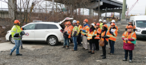
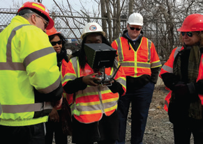
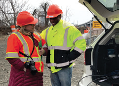
    Field tours demonstrate UAS capabilities to staff and partnering organizations.

  • Bat Counts Under Bridges. North Carolina is using infrared thermography to conduct counts on bat populations under bridges. New Federal regulations require state DOT’s to ensure they do not disturb a protected species while conducting inspections. The NJDOT Division of Environmental Resources has requested UAS assistance in conducting bat counts under bridges because they live in high and dark areas. A thermal imaging camera mounted on a UAS will confirm the presence of bats and should allow the counting of individual bats in near total darkness by detecting their body heat.
  • Thermal Inspections of Concrete Bridge Decks. Infrared thermography of bridge decks is becoming a valuable and cost-effective inspection method for evaluating bridge decks to detect delamination in concrete. The delamination photos can be rendered by addition of higher-end gaming computers into a 3D model that can be used to determine the exact location of each delamination.
  • Large Potholes and Longitudinal Joint Separations. The efficient identification of large potholes and longitudinal joints would require autonomous UAS that can be programmed to safely fly over long distances. Current regulations require small UAS to fly within the line of sight of the operator which makes this use case currently very inefficient and not cost-effective.
  • Thermal Imaging for Paving Project Management. DelDOT is examining the use of UAS to detect significant thermal anomalies during the laying of new asphalt. The UAS would take standard photographs and thermal photos of the same area. The photos would then be compared to detect potential quality issues in the new pavement. Sets of thermal and visual photos can be rendered through higher end gaming computers into a 3D model that can be used to generate a guide sheet to make it easier for work crews quickly find each problem area at the work site.
  • Construction Project Management. Several on-site inspectors, resident engineers, and traffic engineers have commented that the tiny UAS screen located on the UAS controller is difficult for a field team to view. A larger monitor mounted in the rear of the UAS Program vehicle can allow supervisors, upper management, and other non-participants to safely view UAS output in real time without interfering with the movement of the UAS crew.

Three years after its establishment, New Jersey’s UAS Program, continues to reach new heights as it discovers how it can effectively work with NJDOT’s divisions and bureaus to improve safety, increase efficiency, save time and save money in routine operations.  The UAS program challenges both the agency’s leaders and staff to adapt to new technologies, seek the training to develop new skills, and find new ways to collaborate to advance innovations in its transportation operations.

E-Construction and Partnering Peer Exchange

State DOTs presented on e-construction initiatives.

On June 11 and 12th, NJDOT hosted a Peer Exchange on e-Construction and Partnering with the support of FHWA’s designated subject matter expert and support team.  During the two-day event, representatives of five state DOTs and the FHWA NJ division office convened to highlight and share current practices, policies and procedures, funding sources, and implementation challenges (see Agenda and Final Report).

In welcoming participants, NJDOT laid out several topics of interest for the peer exchange.  NJDOT explained that it had recently completed a pilot project using mobile devices in the field.  For that pilot effort, inspectors were able to input inspection data and create reports. The pilot study demonstrated that field data should be captured as quickly as possible, rather than wait until the inspector returns to the office.  NJDOT also sought more insights on using digital signatures securely to further its objective of implementing digital processes and advancing, eventually, toward a paperless system.  The department’s e-Builder process is just getting started with a rollout for construction in the next 3-4 months. NJDOT is also currently collecting data and information about e-ticketing.  With all of this, NJDOT made clear its interest in looking to share and understand lessons learned from other state DOTs to eliminate redundancies and missteps.

NJDOT also gave an overview of its vision for e-construction and how it seeks to use its Project Management Reporting System (PMRS) with e-Builder for final plans and specifications and AASHTOware Project for bid, award, and construction.  Similarly, the participating DOT attendees — Georgia, Indiana, Ohio and Kentucky — described their agency’s experience with various e-construction systems, covering such topics as:  digital signatures; electronic approvals and signatures; cost sharing and partnering; mobile devices; and e-ticketing.

The event provided an opportunity to delve deeply into the technologies with peer agencies, exploring the major benefits, key challenges and lessons learned in implementing select systems. For NJDOT, the event led to several takeaways in relationship to implementation of e-Builder for construction; e-ticketing and data requirements; and building effective collaborative relationships with various bureaus and contractors, among other topics.

Connected Vehicles Program Pilot Testing of Technology for Safety Service Patrol Workers Continues

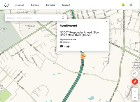
Video screenshot of hazard display message received

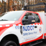
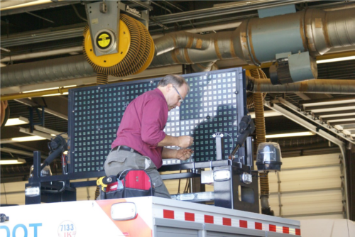
The rise of crowdsourced navigation applications and connected vehicle applications provide new opportunities to relay road service safety information to the motoring public.  NJDOT has initiated a Connected Vehicle: Road Service Safety Message pilot study that evaluates the effectiveness of using connected vehicle technology to alert the motoring public to the presence of safety service workers at an incident site. NJDOT is piloting the use of a Beacon Hazard Lights technology to alert drivers to the presence of workers when safety service vehicles turn on their hazard lights. The piloting of the technology has received the support of the NJ State Innovation Council (NJ STIC) and a STIC Incentive Funding grant of $39,600 awarded by FHWA.

The primary objective behind the initiative is to inform the public of the presence of Safety Service Patrol (SSP) personnel thru various services and applications that share real-time traffic and roadway information once they have responded to an incident or to help a motorist.  A short demonstration video of how a technology-equipped NJDOT safety service vehicle interfaces with crowdsourcing platforms in the field can be accessed here.

Periodic interim reports for the pilot study are being prepared to evaluate the technology’s application during the STIC grant period. Previously, NJDOT and New Jersey Institute of Technology (NJIT) personnel conducted a field evaluation of the technology following the device-equipped SSP vehicle then subsequently maintained a data log of the device’s activity in the field and through mobile and web-based interfaces.  In continuation of this effort, the NJIT team proceeded with a similar analysis by studying the correlation between the data recorded via the device log and the crowdsourced navigation applications web-based interface. In addition, the radio logs maintained by the Safety Service Patrol were used to further support this evaluation effort.


Professional Engineering Design Experience Program Launched at NJDOT – Provides Career Opportunities toward Licensure

NJDOT has launched the Professional Engineering Design Experience Program (PEDE) – an innovative initiative providing current NJDOT engineers with the opportunity to gain the required design experience necessary to achieve their professional engineering (PE) licensure. Engineers expressed the desire to remain with NJDOT and needed the ability to obtain a PE license to reach career goals. In launching the initiative, NJDOT recognized the need and responded to employees with the development of The Professional Engineering Design Experience Program (PEDE).

The PEDE program will offer engineering staff that have a bachelor’s degree in engineering from an accredited university, who do not currently have design responsibilities, the opportunity to work alongside a PE-licensed colleague to gain the design experience required to obtain their own PE license while remaining on the job at NJDOT. The PEDE program will build relationships between staff members as mentors and mentees who meet the program requirements as outlined in the PEDE Program Guidebook.

 width=

Mentees will have the opportunity to design projects such as: crash cushions; guiderails; pedestrian improvements such as sidewalks and ADA curb ramps; minor intersections improvements such as turn lanes, minor widening, corner cutbacks, signing and striping; sight distance issues/improvements; and minor drainage improvements through grading and re-profiling.

The program also creates leadership opportunities through mentorship. Having talented,committed leaders as mentors is critical to the success of the program. A good mentor will be a proven team player, have strong communication skills, and be a good instructor that is willing to encourage and support his or her mentee. Other requirements are outlined in the PEDE Program Guidebook. Employees can review the PEDE Program Guidebook on the NJDOT intranet.

Article adapted from the April 2019 Transporter, the NJDOT employee newsletter.


Local Safety Peer Exchanges: Summary Report

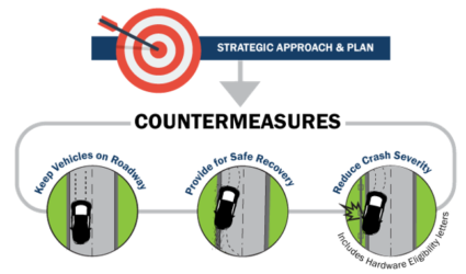
NJDOT, FHWA and NJDOT held a series of three Local Safety Peer Exchange events for municipal and county representatives to share best practices in addressing traffic safety.  These full-day events brought together representatives of NJDOT, FHWA, counties, municipalities, and Metropolitan Planning Organizations (MPOs) to discuss project prioritization, substantive safety, implementation of FHWA safety countermeasures, and use of a systemic safety approach.

The Local Safety Peer Exchanges Summary Report provides an overview of the event proceedings, including the presentations, workshop activities and key observations from the Local Safety Peer Exchanges held in December 2017, June 2018, and March 2019.

The Local Safety Peer Exchanges were funded, in part, though the use of a State Transportation Incentive Funding (STIC) grant.  The Local Safety Peer Exchange events are well-aligned with the FHWA Technology Innovation Deployment Program (TIDP) goal: “Develop and deploy new tools and techniques and practices to accelerate the adoption of innovation in all aspects of highway transportation.”  The focus of the Local Safety Peer Exchanges is also consistent with two of the FHWA's Every Day Counts (EDC-4) Innovative Initiatives: Safe Transportation for Every Person (STEP) which supports the use of cost-effective countermeasures with known safety benefits to address locations of fatal pedestrian crashes; and Data-Driven Safety Analysis (DDSA) that uses crash and roadway data to reliably determine the safety performance of projects.


On December 6, 2017 municipal and county representatives gathered to discuss best practices to address traffic safety. Topics discussed included NJ safety performance targets, use of Safety Voyager, substantive vs. nominal approaches to design, systemic vs. hot spot approaches to safety, and discussion of FHWA safety countermeasures.

The summary report provides documentation of the agenda, presentations, highlighted tools and model practices, and workshop activities for each of the Local Safety Peer Exchange events, including the December 2017 event.

EDC-4 Final Report Highlights Innovations

The EDC-4 Final Report highlights the results of round four of the Every Day Counts program to rapidly deploy proven innovations to enhance the transportation system. “Every Day Counts: An Innovation Partnership With States” documents progress in accelerating the implementation of 11 innovations in 2017 and 2018 and success stories from States across the country.  View the report’s maps and highlights to learn how innovation implementation was advanced across the country.

New Jersey’s use of “Ultra High Performance Concrete (UHPC)” for the Pulaski Skyway deck replacement in northern New Jersey is a featured “Innovation Spotlight” example in this national report.  The report highlights NJDOT’s use of precast deck panels connected with UHPC, stainless steel rebar, and a polyester concrete overlay to maximize the durability of the new deck and minimize the need for future repairs and traffic disruption.  The project is recognized as the largest user of UHPC to date in North America.  Moreover, in 2012, when NJDOT selected UHPC for the Pulaski Skyway only five other transportation agencies had used UHPC for bridge construction.  Since then, the skyway has served as an informative example for other agencies. NJDOT continues to use UHPC connections and completed five other bridges in 2018, bringing the State’s total to nine bridges.

An online version of the FHWA report is viewable here.


Local Access Management Regulations

The New Jersey Department of Transportation (NJDOT) is responsible for administering an access management policy for the state highway system.  The Federal Highway Administration (FHWA) defines access management as “the proactive management of vehicular access points to land parcels adjacent to all manner of roadways. Good access management promotes safe and efficient use of the transportation network.”

Figure 1: Conceptual Roadway Functional Hierarchy. Source: FHWA, 2017

Key components of an access management code include access spacing, driveway spacing, safe turning lanes, median treatments, and right-of-way management. While New Jersey’s access management code is highly regarded, it only applies to state highways and not local roads. Local authorities in New Jersey do not have uniform access management codes, regulations, or standards for local roads. This creates a gap in policy for how to address the issues that arise when new developments take place on local roads near intersections with state routes or when state highway improvements are required near intersections with local roads.

To address these issues, the NJDOT Bureau of Research solicited a research study of local access management regulations. The primary research objective was to identify and recommend strategies, tools, and guidelines to facilitate access management on local roads (i.e., county and municipal) intersecting and/or impacting state highways in New Jersey.

The selected research team sought to evaluate how other state DOTs address access management on local roads near state highways and explore how New Jersey local government and transportation agency officials perceive these access management issues between state and local jurisdictions

The research team carried out several tasks. First, they compiled a literature review of local access management drawing upon resources from state DOTs, the FHWA, the Transportation Research Board (TRB), local governments, among others (see Figures 1 and 2). Next, they organized and facilitated discussions with a stakeholder committee of professionals in New Jersey (e.g., municipal, county, and MPO engineers and planners) with experience addressing access management. The team conducted structured interviews with state DOTs from 13 different states, including California, Colorado, Virginia, and Pennsylvania.  NJ local government officials were reached through an online survey to gather information on current practices, issues, and relevant case studies. The researchers conducted case study analyses of specific problematic issues at intersections of local roads and state highways in New Jersey. Four site locations were selected based on the availability of data, severity of issues, geographic and land use patterns, and the relative difficulty for access management implementation based on the current system.

The interviews with other state DOTs focused on several themes, including the basis and scope of authority given under current access management laws and regulations; issues related to the development of corner lots; proactive steps taken to avoid access management issues; and recommendations for developing and implementing access. From the interviews with the state DOT officials, the research team gleaned that there is substantial variation on access management approaches. Similar to New Jersey, other State DOTs are mostly focused on

Figure 2: Diagram of Intersection Corner Clearances. Source: TRB, Access Management Manual, 2014.

state highways, although many acknowledged facing local-road issues. The team uncovered some best practice strategies that could be pertinent to New Jersey, including the development of corridor agreements between local governments and state DOTs; training local government professionals on access management; establishing communication channels between local offices of state DOTs and local governments; and funding local governments to develop their own access management guidelines and standards.

Stakeholder meetings and surveys of local New Jersey officials revealed broad support for advancing local access management guidelines. Among those surveyed, 27 percent said the local agencies that they served had formal or informal access management guidelines and 60 percent said local access management standards similar to the state highway code would be beneficial. However, key barriers were also identified, including the cost and availability of training. Local officials generally were not in favor of extending NJDOT’s authority beyond the State Highway System to county and local roads, and preferred initiatives from NJDOT to local governments that involved dedicated funding, improved coordination or dialogue, or technical assistance.

Based on the literature review and survey feedback, the research team offered for consideration to NJDOT and local governments some criteria for intersections between state highways and local roads where no local access code or guidelines are available (see Table 1).

The research team also recommended that NJDOT:

  • Develop project-specific access management criteria for intersections between state and local roads in highway improvement projects, which will work to communicate early to local agencies and property owners if they may lose parking, road access, right-of-way, etc.
  • Provide assistance via funding and training to encourage local governments to develop their own access management guidelines consistent with state code yet with more flexibility to their local roads.
  • Provide incentives for local governments to establish and apply access management policies and guidelines (using a similar approach that has been used to encourage Complete Streets policy adoption and implementation training).
  • Adopt proactive measures such as corridor agreements with local governments at corridors with highway improvement projects in the next 5 or 10 years according to the state highway improvement plan of local MPOs and NJDOT and specify the spacing criteria for intersections between state and local roads on selected corridors.
  • Establish communication channels between divisional offices of NJDOT and local governments so that all parties are aware of projects early on.
  • Continue working with the stakeholder committee established for the research study to foster dialogue between NJDOT and local governments on access management

Table 1Criteria of Access Spacing and Corner Clearance based on Posted Speed Limit

Criteria Agency Posted Speed Limit (mph)
25 30 35 40 45 50 55
Minimum Access Spacing Peer State DOTs Minimum Access Separation (feet)
NJDOT(C) 105 125 150 185 230 275 330
Peer State DOTs 125-245 125-245 125-250 245-305 245-440 440-660 440-660
AASHTO Sight Distance

280

(240*)

335

(290)

390

(335)

445

(385)

500

(430)

555

(480)

610

(530)

TRB-Manual** 330 330 330 330 660 660 880
NJ Local Agencies 150-300 200-350 250-425 300-475 350-525 400-600 400-600
Minimum Corner Clearance Minimum Distance from Corner (feet)
NJDOT(C) 50 50 100 100 100 100 100
Peer DOTs Same as Access Spacing
NJ Survey

Same as Access Spacing

Notes: (C) stands for Code/Regulations/Ordinance; (G) Stands for Guidelines/Manual/Standards; * for right-turn-only access points with median blockage; ** TRB Access Management Manual.

The research team also suggested some future work items to further advance implementation. Notably, the development of semi-automated screening tools and GIS overlays could assist in the identification of problematic locations based on state or local intersection spacing criteria. This could help expedite the design process and facilitate proactive communications and problem solving between NJDOT and local governments. Additionally, NJDOT could establish a co-training program for their related departments and local agencies to deliver needed training on general knowledge, prevailing standards and design concepts, institutional procedures, and real-world practice on past state and local access management projects. Based on this report, there is clear evidence of strong support across local and state officials as NJDOT looks to implement these recommendations and further study how to improve current practices.

Sources:
FHWA. “What Is Access Management?” February 15, 2017. https://ops.fhwa.dot.gov/access_mgmt/what_is_accsmgmt.htm

Jin, Peter J., Devajyoti Deka, and Mohammad Jalayer. “Local Access Management Regulations – Technical Brief.” 2019. FHWA-NJ-2018-003 TB

Jin, Peter J., Devajyoti Deka, and Mohammad Jalayer. “Local Access Management Regulations – Final Report.” 2019. FHWA-NJ-2018-003

Williams, Kristine M., Vergil G. Stover, Karen K. Dixon, and Philip Demosthenes. Access management manual. 2014. https://trid.trb.org/view/1341995