FHWA’s Ray Murphy Presents EDC-5 Weather-Responsive Management Strategies

On April 14, 2020, the NJDOT Bureau of Research hosted a Lunchtime Tech Talk! webinar on "EDC-5 Weather-Responsive Management Strategies." This event featured a presentation by Ray Murphy, ITS Specialist with the FHWA's Resource Center. Under Round 5 of the Every Day Counts (EDC) program, FHWA promotes Weather-Responsive Management Strategies (WRMS) to manage traffic and road maintenance during inclement weather to improve safety and reliability, and minimize environmental impacts associated with weather events. Weather affects: traffic safety, with 21 percent of the nearly 6 million roadway crashes in the past decade related to weather; mobility, resulting in reduced efficiency and productivity; and environmental impacts on watersheds, air quality, and infrastructure.
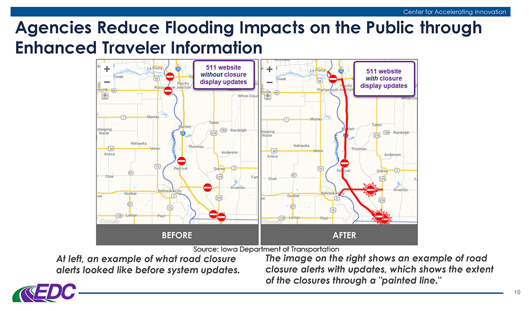
Mr. Murphy provided examples of weather responsive practices being tried by state DOTs, including an advanced traveler information notification deployed by Iowa DOT.

Mr. Murphy provided examples of weather responsive practices being tried by state DOTs, including an advanced traveler information notification deployed by Iowa DOT.

Mr. Murphy described the prior-round, EDC-4 innovation, Road Weather Management – Weather-Savvy Roads, that formed the basis for this EDC-5 initiative. The innovation promoted data collection including Pathfinder, a collaboration between the National Weather Service, state DOTs, and state support contractors to provide weather information and forecasts, and Integrating Mobile Observations (IMO) that collects weather and road condition data from instruments on agency fleet trucks.

Through WRMS, FHWA promotes the use of mobile data to support decision making. Benefits to agencies include improved safety, system performance and operations, and reduced costs and environmental impacts. Agencies can use Weather Responsive Management Systems to address diverse internal needs such as staffing, material use, and route optimization, and condition and performance reporting. Data sources include transportation agency fleets, private vehicles, third party entities, agency operators, road users and infrastructure. Some data is collected by in-vehicle sensors, video and camera images, and automatic vehicle location. Other data sources include fixed Roadway Information System (RWIS), National Weather Service, reports from road users and operators, mobile observations and connected vehicle data, among others.

The traveling public benefits through safer pre-trip and real-time route decision making based on enhanced traveler information, roadside messaging, variable speed limits, and road lane closures or restrictions. Unified, localized, and more accurate messaging gives the public increased confidence in the messaging and the agency.

Mr. Murphy addressed some common challenges that agencies face in adopting this innovation, such as a lack of connectivity in remote areas, the need for buy-in from agency leadership and from road crews, hesitance to adopt the innovation, and funding.
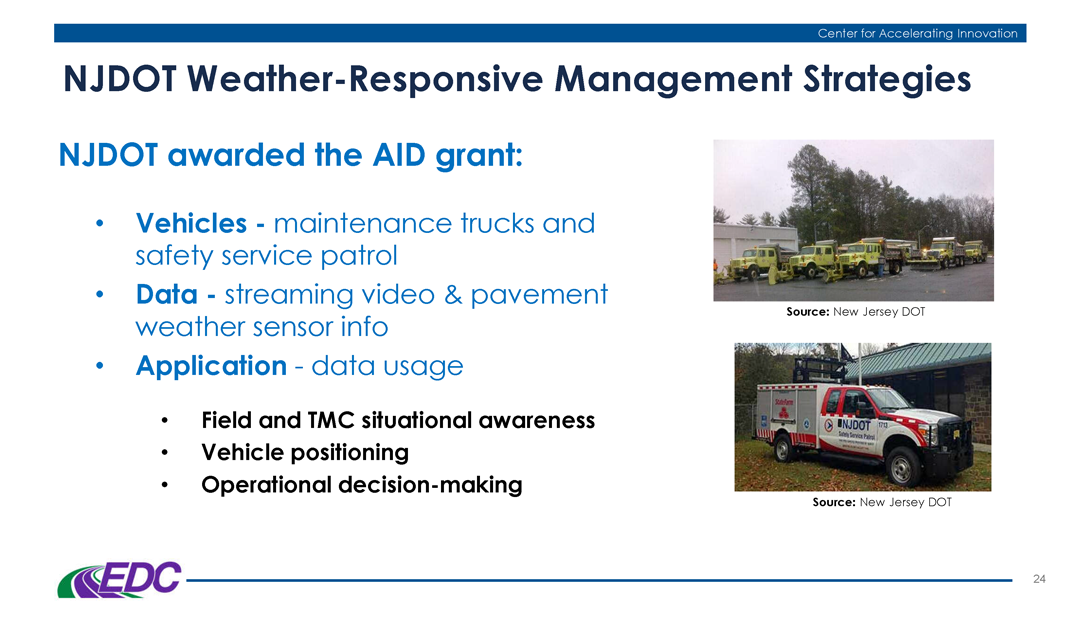
Mr. Murphy cited some of work that NJ DOT has accomplished in the field of Weather Responsive Management Strategies.

Mr. Murphy highlighted recent initiatives undertaken by NJDOT related to Weather Responsive Management Strategies that have been funded in part through FHWA innovation grants.

He noted that the State Transportation Innovation Council (STIC) Incentive Program and STIC Accelerated Innovation Deployment (AID) grants can help fund implementation of these technologies. NJDOT received a STIC incentive funding grant to support pilot testing of technology used by the Safety Service Patrols. NJDOT was also awarded an AID Grant from FHWA to support a weather savvy roads pilot program, installing video camera dashboards and sensors onto NJDOT maintenance trucks and safety service patrol vehicles to collect streaming video and weather / pavement information to support road weather management throughout the state.

Webinar participants had an opportunity to pose questions of Mr. Murphy. One participant asked about possible resistance to installation of automatic vehicle locators due to privacy concerns. Mr. Murphy noted that agencies must operate openly and inclusively when implementing this technology. Training and education can help users become more accepting of the technology.

A participant asked about the use of IMO data versus information gathered from a public entity such as WAZE. Mr. Murphy responded that the agency receives the IMO data directly and can oversee the accuracy of the data, but that information should come from multiple sources to create a robust dataset.

When asked what agencies consider the biggest challenges, and what arguments can be used to support this innovation, Mr. Murphy responded that funding is always a concern but that buy-in is often the larger issue. He emphasized the need for a champion who can demonstrate the benefits of the strategies through performance measures.

When asked if specific applications of WRMS were being considered for EDC-6, Mr. Murphy responded that various innovative practices were being considered and no decisions had been made yet.

A participant asked if these systems can be adapted to rockfall data. Mr. Murphy noted that visibility apps used with dust storms or fire events could be adapted for other weather events.

Mr. Murphy’s presentation offered several examples of DOTs nationwide employing these strategies. A participant asked if any states are quantifying the benefits of WRMS implementation. Mr. Murphy offered that Caltrans is one agency.

The presentation given by Mr. Murphy can be downloaded here.

More information on this innovation is available on the FHWA Weather Responsive Management Systems resources page.

A recording of the webinar is available here, (also to the right).

TECH TALK! Webinar: EDC Safe Transportation for Every Pedestrian

UPDATE: This live webinar has been postponed and will be rescheduled for a later date.

Those who are registered will remain registered.


Please join the NJDOT Bureau of Research on April 2nd for an Innovation Exchange Webinar, “EDC Safe Transportation for Every Pedestrian (STEP)”, that we are convening in Training Room A in the E&O Building at NJDOT Headquarters.

Safe Transportation for Every Pedestrian (STEP), an Every Day Counts (EDC) innovation, is about a new type of “STEP” to keep pedestrians safe at uncontrolled road crossing locations. This webinar will outline five cost-effective countermeasures available to local agencies, and identify resources to guide in their selection and installation. Stories from local agencies will tell of county, city, and Tribal deployment leadership, with details on site and countermeasure selection, installation, monitoring, and improved safety measures of success.

AICP and NJ PE credits are available. This “live” webinar event is free to attend, but you must register ahead of time to guarantee a seat as there is limited space in the training room:

WEBINAR: EDC Safe Transportation for Every Pedestrian (STEP)

POSTPONE AND WILL BE RESCHEDULED.

Time: 1:00 PM – 2:30 PM; Sign-in: 12:50 pm
Location:  NJDOT E&O Building, Training Room A
1035 Parkway Avenue, Trenton, NJ 08625

This Innovation Exchange webinar is one in a series sponsored by the Center for Local Aid Support (CLAS) in the Federal Highway Administration’s Office of Innovative Program Delivery.  Through Innovative Exchange webinars, CLAS is bringing cutting-edge transportation leaders to the table to share ideas and out of the box innovative practices that have proven results.


Tech Talk! Webinar: The Connected Job Site

On November 14, 2019, FHWA sponsored an innovation exchange webinar, "The Connected Job Site," that was live broadcast by the NJDOT Bureau of Research as part of its Tech Talk! series, for NJDOT staff at NJDOT Headquarters in the Foran Building Training Room.

With the recent influx of new technologies such as smartphones, tablets, and drones, and their growing and widespread availability, many ingenious applications have been developed for their effective deployment in construction and operations and maintenance activities in transportation. These technologies have allowed for real-time project monitoring, improved communication among team members, documentation stored on the cloud, and more efficient online scheduling. During this webinar, attendees learned about what exactly connected job sites are, and how various local agencies from around the country have started to utilize these technologies in innovative ways.

FHWA launched the webinar with a short presentation, Ten Examples of Connected Technologies, that highlighted examples of tools and technologies found on the connected job site. The primary objective behind the adoption of these connected technologies is to save time and money and improve safety in operations.  Hardware like smartphones, tablets, laptops, wearable technology and various vehicles and equipment have streamlined communications and planning in performing field work, while software solutions like 3D Modeling and Building Information Modeling (BIM) have improved the accuracy and efficiency of digital representation for physical facilities and infrastructure design. Virtual reality (VR) technologies have also started to find applications in the field, allowing professionals to safely experiment and test ideas in an artificial environment and bring products and concepts to life through visualizations.  Using VR in conjunction with drone technology, for example, has allowed maintenance crews to safely examine parts of bridges that were previously hazardous to inspect. The advent of unmanned aerial vehicle systems, in general, has provided the ability to garner visual information at a lower cost than traditional methods, while keeping workers out of harm’s way.

Connected job sites do not always have to deploy new technologies; sometimes they just re-purpose applications of older technologies in conjunction with new ideas. GPS systems have been around for decades, but when used with new software they are immensely effective in improving efficiency.  Two case examples of this were provided by the local public agencies who participated in the webinar.

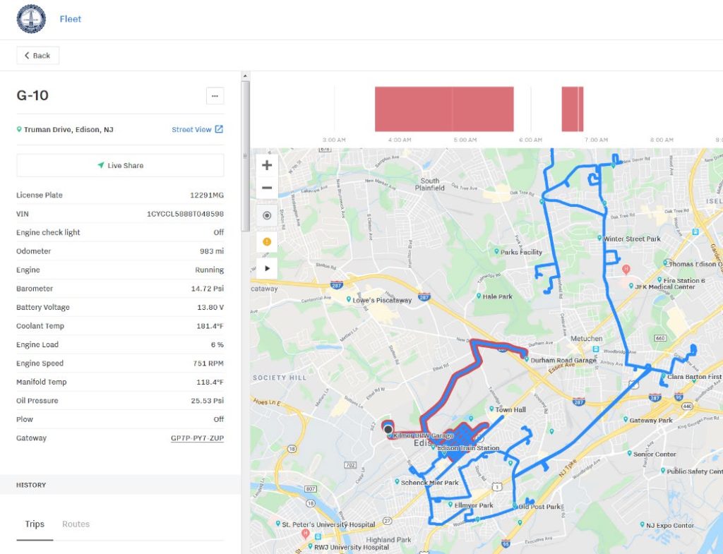
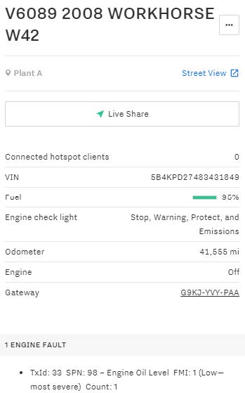
Township staff can review actual snow plow routes to improve cost-effective coverage and verify citizen complaints

The Township of Edison’s presentation, Improve Fleet Operations Through the Use of GPS and Telematics, provided by the New Jersey municipality’s Information Technology Manager, described some benefits and challenges of the installation of GPS tracking devices on its vehicle maintenance fleet.  During snow events, the Township was able to monitor the entire routes taken by its snow plow trucks and the specific segments where the plows were used.  Once the monitoring systems were in place, the Township found that it had the capability to more effectively evaluate individual citizen complaints of streets not being plowed adequately.  For example, the Township could check its mapped records of fleet route deployment during storm events, and see if the complaints were "true" and then determine whether a specific snow removal job needed to be repeated.  More broadly, the tool allowed the agency to ascertain whether designated routes were being followed by operators and whether the priority routes themselves were efficient and effective in both design and operation.

This capability had the added benefit of reducing the Township’s liability for alleged property damage. In fact, the Township found that some 50 percent of the claims that asserted that snow plows were hitting parked vehicles could not be substantiated after checking the GPS location of the snowplow trucks and their route history. Insurance claims and payouts were reduced by some 60 percent due to this capacity to technically validate the potential merits of a claim. The Township also found that it was able to improve efficiency in route designs, leading to less wear and tear on equipment, less use of salt and brine, and a reduction in person-hours and overtime costs.

The Township touched upon tool features that improved the monitoring of vehicles for preventative maintenance. As vehicles systems were now connected to a central hub, needed repairs were identified more quickly and systematically, and less dependent on individual driver reports of faults in a vehicle's operation.  Eventually, low use and high maintenance cost vehicles were better identified and retired, allowing for an overall fleet reduction of 35 percent which, in turn, has reduced costs for fuel, insurance, parts and labor.

For Lauderdale uses available individual vehicle operations measures to improve safety and support preventative maintenance progam for its fleet.

The City of Fort Lauderdale’s presentation, How to Improve Fleet Sustainability, jointly given by the City’s Program Manager for Fleet Services and their Automotive and Equipment Specialist, described several features and benefits of their fleet management program, including the use of geofencing. A geofence is a virtual perimeter dynamically generated for a real-world geographic area around a point location, or a predefined set of boundaries. It is typically used for security purposes and to better track people and equipment. Fort Lauderdale used geofencing to help preserve its infrastructure, as it was able to monitor overweight trucks using historic bridges; with this real time technology, they were able to reduce over-weight vehicles crossing the bridge by nearly 90 percent.

Vehicle tracking had the side benefit of making their drivers operate more safely.  The City found that its personnel were less likely to go over the speed limit if they were monitored, and “harsh events” such as braking and sharp turns were also reduced.  Examples of some of the specific and aggregate dashboard performance measures that can be monitored for equipment usage were highlighted.

In the dialogue following both presentations, it was clear that the adoption of the connected technologies changed the way business is being performed. Notably, the tools and performance measures permit increased tracking of the workforce on-the-job.  The presenters acknowledged that it can raise concerns about the level of monitoring available to the local public agency's management team.  However, according to the presenters, the implementation of the systems has generally improved the safety and efficiency of daily operations and contributed to improved maintenance and longevity of their fleets.

While the webinar shared just a couple of case examples primarily focused on fleet management, the FHWA hosts stressed that the future of connected job sites will only grow as the “internet of things” becomes more complex. Everything from automated vehicles, intelligent compaction, drones, and RFID scanners will continue to find new applications, and new ways to save money and enhance safety.

The Connected Job Site webinar is one in a series of Innovation Exchange webinars sponsored by the Center for Local Aid Support (CLAS) in the Federal Highway Administration's Office of Innovative Program Delivery. Through Innovative Exchange webinars, CLAS seeks to bring cutting-edge transportation leaders to the table to share ideas and out of the box innovative practices that have proven results.  More information about this webinar, upcoming webinars, and webinars available on demand can be found here.

Tech Talk! Webinar: Crowdsourcing for Local Operations

As the technology and portability of communications have become more widespread and instantaneous, "crowdsourcing" has become an increasingly popular method for identifying and addressing problems quickly. Crowdsourcing enables an organization to distribute workloads across a large group of people, utilizing their collective wisdom and amplifying the reach of the organization. Long popular for applications such as customer reviews for shoppers and critical takes from moviegoers, crowdsourcing tools are spreading in transportation and transforming the way operating agencies work with the public.  Most often we have seen crowdsourcing used on apps like Waze for up-to-date traveler information or incident management, as these apps allow for every driver on the road to serve as the eyes and ears of the larger community.

On October 17, 2019, FHWA sponsored an innovation exchange webinar, "Crowdsourcing for Local Operations" that was “live” broadcasted by the Bureau of Research as part of its Tech Talk! series, for NJDOT staff who convened in the E&O Building, Training Room A.  The webinar illustrated how local agencies are working, often with state partners, to expand the use of crowdsourcing across a wider set of application areas.

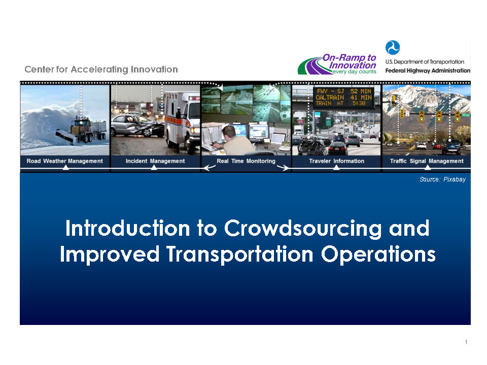
FHWA kicked off the webinar with a brief presentation, Introduction to Crowdsourcing and Improved Transportation Operations, that provided a definition and historical context for crowdsourcing, and a summary of typical sources of crowdsourcing data and applications in transportation.  The presentation included an overview of the Every Day Counts (EDC) Program and technical assistance resources available at FHWA to support deployment of crowdsourcing.  However, the primary purpose of the event was to showcase examples from around the country where Local Public Agencies and partnering stakeholders have deployed crowdsourcing solutions for emergency management, roadway and other  maintenance, and wildlife protection.

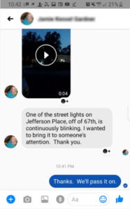
City of Myrtle Beach uses Facebook comments, direct messages, emails, phone calls, and other tools to receive citizen input.

Crowdsourcing Using Social Media for Emergency Roadway Management, City of Myrtle Beach, South Carolina.  Mark Kruea, Public Information Director, described how the City of Myrtle Beach uses social media to help engage with residents quickly and effectively. The city takes phone calls, e-mails, and even messages and comments on Facebook on every topic, including trimming trees, fixing potholes, broken street lights, and other maintenance and needed capital improvements. The city tries to address requests within the same day which, in turn, encourages residents to use the system more frequently as they realize the city is listening and acting on suggestions. Mr. Kruea said that there was no reporting "threshold" for when a city would act on a specific comment or request, and even a single report of an issue can trigger a response.  His talk made clear the potential benefits of fostering a strong trust between the community and the municipality, particularly in planning for and managing emergency situations.  For example, during Hurricane Dorian, residents were able to send pictures of downed trees for clean-up crews to address, and adjustments were made to the storm level capacity of a regional detention pond prior to the storm event in response to community requests.

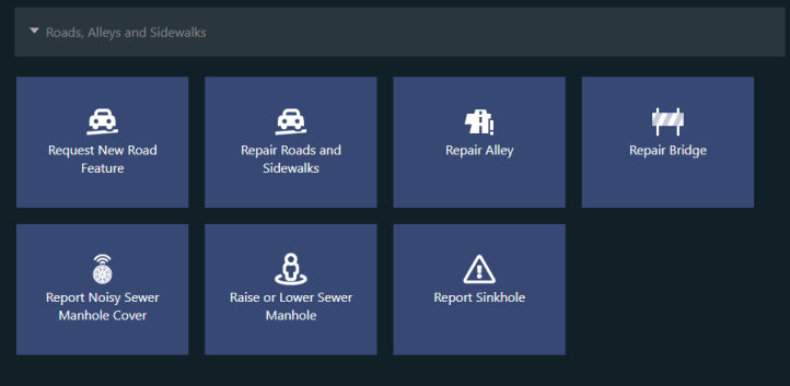
City of Richmond’s 311 portal makes it easy for citizens to report and track non-emergency service requests.

Crowdsourcing for Road Maintenance, City of Richmond, Virginia. Peter Briel, Director, Citizen Service & Response, spoke about the City of Richmond’s establishment of a 311 portal – phone, public internet portal, smartphone app -- for intake of most citizen requests for non-emergency services.  The 311 program includes a call center, a request platform, and performance reporting.  Once received, citizen requests are categorized by type and automatically routed to appropriate teams within the City’s various departments. Citizens can report a range of road issues through RVA311, including requests for new road infrastructure to report issues with maintenance, signage, traffic signals, and storm drain cleaning, among others. Citizens are able to upload photos through the app or the internet, check the status their requests, and receive push notifications when updates have been made by the city.  Mr. Briel’s presentation highlighted some of the mapping and performance management measures available in using the 311 system along with some of the organizational, technical and cultural changes required for deploying the tool for the city residents and workforce. He noted that the most challenging part of implementation of the innovation was initiating the culture change between the citizens and the city so the 311 system would not become simply an app for complaints, but instead, for citizen empowerment.

While the first few presentations dealt with infrastructure maintenance and emergency response, the next two presenters showed how crowdsourcing could be used to avoid wildlife collisions and protect their habitats.


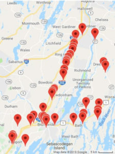
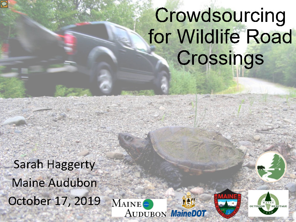
Maine Audubon uses an online tool, Wildlife Road Watch, to identify roadkill “hot spots”.

Crowdsourcing for Wildlife Road, Maine Audubon Sarah Haggerty, a Conservation Biologist with Maine Audubon, described how her organization in association with Maine Department of Transportation and other environmental protection organizations, have worked to identify the worst areas for animal fatalities in order to prevent future accidents. Using an online tool created by the University of California-Davis Road Ecology Center, residents are able to upload photos and locations where they encounter roadkill, allowing the tool to identify hotspots around the state. In turn, municipalities can construct road-stream crossings that make it safe for wildlife passage as well as vehicular traffic, a strategy that was incentivized through extra points in state grants.


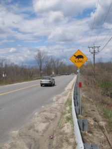
MassDOT has used historic roadway mortality data reported by citizen scientists and its maintenance personnel to prioritize and design signage, fencing, and crossings to protect wildlife endangered by traffic.

Linking Landscapes for Massachusetts Wildlife, Massachusetts Division of Fisheries and Wildlife. David Paulson, a Senior Endangered Species Environmental Specialist, described how his agency is working to incorporate habitat conservation into transportation planning and project development.  Through the use of volunteers and MassDOT maintenance personnel, historic data on wildlife roadway mortality on particular road segments have been compiled.  Citizens and workers have been asked to report locations where multiple turtles experience roadway mortality on a yearly basis, typically on roads which bisect wetlands. Concurrently, they also enlisted volunteers to help research amphibian migrations across roadways to establish documented migration routes that could be engineered around. The online tool collected data on location and roadkill numbers, giving Massachusetts a good idea of where countermeasures could be implemented.

Throughout the webinar, presentations highlighted different ways in which transportation system users and citizens can be turned into real-time sensors on system performance, providing low-cost, high-quality data on traffic operations, roadway conditions, wildlife mortality, and maintenance issues.  Using crowdsourcing as a tool to garner information met with success in each of these cases, and the resulting actions taken by state and local governments have promoted trust between users and governing agencies.  Given its wide-ranging impact and low costs to implement, FHWA surmised in closing that these and similar tools leveraging engagement would become industry standards in the future.

The Crowdsourcing for Local Operations webinar was one in a series of Innovation Exchange webinars sponsored by the Center for Local Aid Support (CLAS) in the Federal Highway Administration's Office of Innovative Program Delivery. Through Innovative Exchange webinars, CLAS seeks to bring cutting-edge transportation leaders to the table to share ideas and out of the box innovative practices that have proven results.  More information about this webinar, upcoming webinars, and webinars available on demand can be found here.